

Tour des Bauges - 6-day hike
Itinéraire

 Departure/Arrival
 Point of interest
Circuit n° 1
Car access and plenty of parking at La Féclaz.
Access by bus with Synchromontagne, ask at the tourist office.
Access by bus with Synchromontagne, ask at the tourist office.


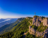
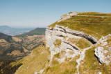

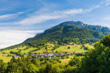
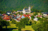
During this hike, deep in the Bauges Regional Natural Park, you will discover a genuine and contrasting mountain range, alternating between vast forests on the Revard plateau to the alpine pastures and cliff faces at the heart of the Bauges.
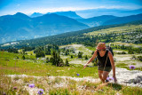
This morning the sun is shining on La Féclaz. The temperature is a little cool at this altitude, but it's ideal weather to start a day's hiking.
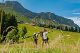
We start slowly, crossing the Nordic plateau. You can imagine it covered in snow in winter, with skiers hurtling down the slopes.
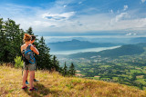
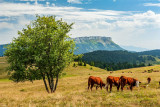
Once you've reached Le Revard, the view over the Lac du Bourget plain is splendid. Just in time, it's picnic time at the Tome des Bauges!
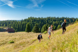
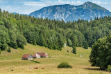
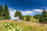
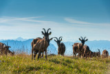
Back on the Chemin des Crêtes. Then it's back down to the mountain pastures and the Baujus chalets, waving to the cows as we go. Only the Col de la Cochette remains to be crossed before we reach the Refuge du Creux de Lachat. The warden's welcome and beer on the terrace are the perfect way to round off such a beautiful day.
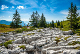
After a good night's sleep, we're ready to continue our adventure in the Bauge region, which still holds a few surprises in store: gorges, caves, cliffs, ice houses and even a Devil's Bridge...
Looking forward to tomorrow!
We start slowly, crossing the Nordic plateau. You can imagine it covered in snow in winter, with skiers hurtling down the slopes.
Once you've reached Le Revard, the view over the Lac du Bourget plain is splendid. Just in time, it's picnic time at the Tome des Bauges!
Back on the Chemin des Crêtes. Then it's back down to the mountain pastures and the Baujus chalets, waving to the cows as we go. Only the Col de la Cochette remains to be crossed before we reach the Refuge du Creux de Lachat. The warden's welcome and beer on the terrace are the perfect way to round off such a beautiful day.
After a good night's sleep, we're ready to continue our adventure in the Bauge region, which still holds a few surprises in store: gorges, caves, cliffs, ice houses and even a Devil's Bridge...
Looking forward to tomorrow!
General
- Equipements et services :
- Animaux acceptés
- Route :
- Type of itinerary BOUCLE
- Marked route
- Distance (in km) 80
- Duration of roaming (in days) 6
- Maximum altitude (in m) 1680
- Height difference (in m) 3140
- Positive elevation gain (in m) 3140
- Negative elevation gain (m) 3140
- Levels of sporting experience :
- Level red – hard
Download
Contact
Tour des Bauges - 6-day hike
La Féclaz Parking du Carcey , Parking plateau su
73230
La Féclaz
Phone : +33 4 79 54 84 28